From Scenic Drive, El Paso and Juárez Spread Out in a Single View
The overlook on Scenic Drive frames El Paso and Ciudad Juárez in one view — two cities, two countries, and a century of local tradition.
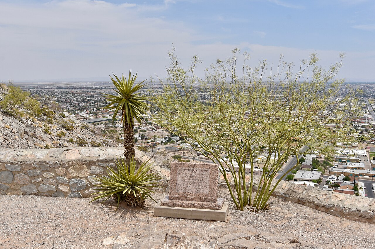
Scenic Drive curves along the southern face of the Franklin Mountains above central El Paso, and its overlook — at Murchison Park — is the city's classic viewpoint. From the pull-off, the view takes in downtown El Paso, the Rio Grande, and Ciudad Juárez beyond it: two cities, two countries, and three states visible in a single sweep on a clear day.
The idea of a sightseeing road along the mountain base dates to the late nineteenth century, and the roadway opened to the public in 1920. It has been an El Paso ritual ever since — the drive taken with visiting relatives, on first dates, after Sunday dinners, and at sunset, when the lights of both cities come on across the valley floor.
The overlook includes benches, walking paths, and interpretive markers that help visitors read the landscape in front of them: the river bend, the international bridges, the mountain passes that have made this corridor a crossroads for centuries. Weekend evenings are the busiest times, and gates at both ends of Scenic Drive can regulate traffic when crowds grow.
For newcomers, Scenic Drive is the fastest orientation lesson El Paso offers. The city's east–west sprawl along Interstate 10, its older neighborhoods at the mountain's foot, and its relationship with Juárez all make immediate sense from the overlook in a way no map quite matches.
The drive costs nothing but time, and it changes with the hour — hard desert brightness at midday, long shadows in the afternoon, and a carpet of lights after dark. It is no accident that for generations of El Pasoans, this is where the city shows itself off.